Mossop, David H.
Person Preferred Name
David H. Mossop
Affiliation
Related Works
Content type
Digital Document
Description / Synopsis
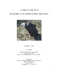
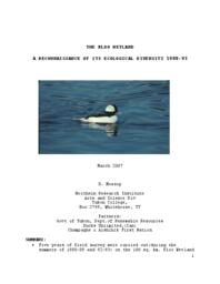
"This survey was largely reconnaissance. A good understanding of the area by the original people of the area exists. The focus of this work was to establish a baseline of science-based data to complement that historic local knowledge. Our tasks were to: a) Develop a basic understanding of why the physical wetland system exists; b) Describe generally the habitat the system provides, c) Quantify the populations of waterbirds and other riparian species using the wetland, d) Describe the use made of the wetland, e) Suggest conservation criteria for the future planning of the area. " (from INTRODUCTION)
Origin Information
Content type
Digital Document
Description / Synopsis
"The 48-km stretch of the Yukon Valley from the mouth of Tatchun Creek to Minto Crossing was surveyed. 110 islands, just over 50 back channels, plus 14 off-channel ponds constitute the wetland habitat most used by birds. Two key areas were groupings of islands and mid-channel bars, one near Yukon Crossing and one near the mouth of McCabe creek. We found 31 species of water birds using the area. Vegetation on river bars and islands was key. In constant successional stage, riparian willow bordered by a grass and sedge community with horsetail as the key emergent was used principally by migrating waterfowl. Breeding by waterfowl was a minor use, (5 species). A relatively dense assemblage of birds of prey indicate a highly productive area: 6 pairs of Bald eagles and 3 pairs of peregrine falcons were recorded. The inordinate mix of islands and cut off channels in the region with its obvious use by spawning salmon are key to the reason the area has such high local value. Moose, wolves, bears and a variety of small mammals along with 95 species of birds were found using the habitats of this river reach. Protecting the ecology of the area will involve maintaining the current hydrologic regime, protecting critical habitats from disturbance and avoiding contaminating the key back channels and inflow streams."--from Summary.
Origin Information
Content type
Digital Document
Description / Synopsis
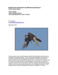
These projects mostly use bird species diversity and population performance as indicators of ecosystem health. In part using student energies, data bases are maintained tracking key demographic parameters of important focal species. Some of these now have well over 40 years of data. 2016 was the 19th year that this initiative has been based at Yukon College; in part the vision has been to contribute toward Yukon’s commitment under the Canadian Biodiversity Strategy (1993), and to foster partnership between the Yukon Research Center at Yukon College and the various management authorities for wildlife in the Yukon.
Origin Information
Content type
Digital Document
Description / Synopsis
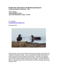
These projects mostly use bird species diversity and population performance as indicators of ecosystem health. In part using student energies, data bases are maintained tracking key demographic parameters of important focal species. Some of these now have well over 40 years of data. 2015 was the eighteenth year that this initiative has been based at Yukon College; in part the vision has been to contribute toward Yukon’s commitment under the Canadian Biodiversity Strategy (1993).
Origin Information
Content type
Digital Document
Description / Synopsis
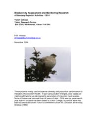
"These projects mostly use bird species diversity and population performance as indicators of ecosystem health. In part using student energies, data bases are maintained tracking key demographic parameters of important focal species. Some of these now have well over 40 years of data. 2014 was the seventeenth year that this initiative has been based at Yukon College; in part the vision has been to contribute toward Yukon’s commitment under the Canadian Biodiversity Strategy (1993)."
Origin Information
Content type
Digital Document
Description / Synopsis
The Kloo Wetland is an area of approximately 100 sq. km. of just over 340 small to medium sized ponds and lakes associated with the floodplain of the Jarvis River in the South Western Yukon. It includes two larger lakes, Kloo and Sulphur, and is about 30 km NW of the village of Haines Junction, YT. In 1980, an area of 447 sq. km. including the wetland was identified as ‘critical’ wildlife habitat by map notation for Land Use decision purpose (Yukon Waterfowl Management Plan, 1985, 1990). This designation was based simply on the obvious concentration of waterbodies and the area’s known value to wildlife species and to local people.
Origin Information
Content type
Digital Document
Description / Synopsis
Companion studies of Willow Ptarmigan (Lagopus lagopus) and Gyrfalcons (Falco rusticolus) in the central Yukon from 1978 to 1983 allowed us to examine Gyrfalcon reproductive performance at 14 nest sites in relation to ptarmigan abundance and other potential effects, including weather variables, the previous year’s success, nest site characteristics, and Golden Eagle (Aquila chrysaetos) nesting density. Ptarmigan abundance declined six-fold and was mirrored by a significant decline in Gyrfalcon breeding success (breeding failure 58%, clutch desertion 33%). Clutch size showed little variation, although deserted nests held fewer eggs than did successful nests, and there were more four-egg clutches when ptarmigan were most abundant. An average of 2.26 young fledged per nest during abundant ptarmigan years, and 0.l8 when ptarmigan were declining. No other factors were correlated with Gyrfalcon reproductive success. Juvenile ptarmigan density had a compensatory effect: even when ptarmigan breeding numbers dipped, Gyrfalcons bred successfully if the proportion of juvenile ptarmigan was high. Clutch initiation date was a good predictor of Gyrfalcon breeding performance. Early clutches had more eggs (67% with 4 eggs compared to 27% in late nests), were less likely to be deserted (5% vs. 59%), and fledged more young (93% vs. 38%). Two Gyrfalcon pairs, supplemented with food in a poor ptarmigan year, fledged young at a rate and schedule comparable to pairs during a peak ptarmigan year. We discuss interesting observations about Gyrfalcon brood success, as well as Golden Eagle nesting density as a potentially important aspect of the reproductive ecology of Gyrfalcons in this population.
Origin Information
Content type
Digital Document
Description / Synopsis
From the late 1950s to the present, several study plots across the Yukon have been variously surveyed annually for territorial Willow Ptarmigan (Lagopus lagopus). Beginning in the mid-1970s, Gyrfalcon (Falco rusticolus) breeding numbers in the same tundra systems have been monitored annually. These data are held in a long-term data base. Monitoring has supported studies of winter survival strategies, tests of population change theory, and reproductive strategy. Willow Ptarmigan are seen as a ‘keystone’in the tundra community. Understanding and tracking very basic trophic interrelationships with the Gyrfalcon, the top predator, has been a major effort at community study. Stable, regular, synchronous, 10-year cycles have been demonstrated in both species. However, beginning in 2000, monitoring surveys have been suggesting the regular cycling of ptarmigan abundance may be faltering—the population peaks seem to be disappearing, although there is no evidence of imminent local extinctions. The potential consequence to the tundra ecosystem is suggested in disruption at the top of the food chain—Gyrfalcons are breeding much later, may be producing fewer young, and seem to be declining in abundance. Simple modeling suggests Gyrfalcon productivity through the few years of peak ptarmigan productivity maybe critical. It will be important to maintain longer monitoring to demonstrate conclusively this change as well as causes.
Origin Information
Content type
Digital Document
Description / Synopsis
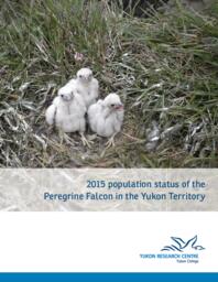
The 2015 survey was an attempt to visit a representative sample from all sub-populations of peregrine falcon known in the territory. The peregrine in the Yukon is thought of as a classic ‘metapopulation’ (McCullough, 1996). The groups, in part based on geographic separation Figure 1), are mostly identified by demographic performance differences. (The subgroup nesting on the ‘North Slope’ is considered to be of the tundrius race.) Past findings have been detailed in a series of reports and published papers dating from the early 1970’s (Cade & Fyfe 1970, Hayes & Mossop 1982, Mossop & Baird, 1985, Mossop 1986, Mossop & Hayes 1980, Mossop & Mowat 1990, Mossop, 1995, 2000, 2005, 2014).
Origin Information
Content type
Digital Document
Description / Synopsis
This survey is the Yukon section of the Canada-wide periodic monitoring of the status of the Peregrine Falcon, a requirement of the Canadian Recovery Plan for the species. Historically, this effort began in the 1960’s when a population of the interior race of peregrine falcon (Falco peregrinus anatum) was first described breeding on the riparian cliffs of the rivers draining the central Yukon (Cade and Fyfe 1970). The birds’ numbers subsequently crashed and more recently have been recovering.
Origin Information
Content type
Digital Document
Description / Synopsis
This survey was the Yukon section of the Canada-wide periodic monitoring of the status of the Peregrine Falcon, a requirement of the Canadian Recovery Plan for the species. The Yukon, through the Northern Research Institute at Yukon College maintains a database spanning three decades tracking the fortunes of Yukon’s peregrines. Historically, this effort began in the 1960’s when a population of the interior race of peregrine falcon (Falco peregrinus anatum) was first described breeding on the riparian cliffs of the rivers draining the central Yukon (Cade and Fyfe 1970). The birds’ numbers subsequently crashed and more recently have been recovering. The Yukon Government has funded this effort in large part over the years; most recently as part of a biodiversity assessment partnership with Yukon College.
Origin Information
Content type
Collection
Content type
Digital Document
Description / Synopsis
Purpose: The Kluane First Nation is planning to install three wind turbines to produce electric power for the community. The elders of the community have expressed concern that the Burwash wind turbine site is within a known major bird migration corridor both spring and fall. A large percentage of the world population of trumpeter swans passes the site. As well a large assemblage of vulnerable birds of prey including the much localized race of buteo hawk, the Harlan’s hawk, potentially use that route. A small amount of migration watch survey has been conducted in the past. It shows a sizeable movement of birds along the shoreline of Kluane Lake. The potential for bird deaths by collision is real. Even though its effect at the population level may possibly be negligible, its perceived effect could be devastating to the project. It is going to be necessary to plan this project very much as an experiment: (If the chosen site proves unfavorable, moving probably should be planned.)” – p.2.
Origin Information
Content type
Digital Document
Description / Synopsis
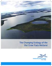
This work grew from concern expressed principally by elders of the Vuntut Gwitchin First Nation, that the wetlands of the Crow Flats upon which generations have depended, are showing distressing changes. The thought was that, remembering several citizens were involved in wetland research about 40 years ago, a new but similar effort could document and perhaps explain those changes." -- from pg. 2.
Origin Information
Content type
Digital Document
Description / Synopsis
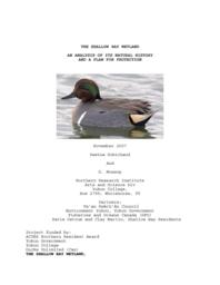
Shallow Bay is a 230 hectare wetland at the south end of Lake Laberge in the southern Yukon. It has been central to the original use of the area by the Ta’an Kwachan first nation. It is an important waterfowl staging area; a key fish spawning and rearing area, and is used by moose, beaver, bear, mustelids, muskrats and a host of bird species. We found 36 species of water birds using the area; banded waterfowl showed birds from all North American flyways except the Atlantic were using the area. Most use by water birds was for staging although at least 4 species were breeding. Over 100 species of songbirds were observed and at least 17 species were breeding. Wood frogs, and 9 species of fish were identified. 6 species of birds of prey were found hunting in the wetland; only N.goshawk was found breeding. The vegetation community consists of three major zones: aquatic, emergent and riparian periodically flooded shrub. Water of the bay is mostly from the one small inflow creek, Horse Creek, although annually silts from the major Yukon drainage contribute to the benthics of the wetland. Critical to the area’s ecology is the hydrologic regime of annual flooding of the emergent and riparian shrub zones. The flooded riparian zones are heavily used by brood rearing water birds and by many thousands of young fish. Benthic and aquatic invertebrates represent much of the area’s biomass. Protection measures and planning for the areas future must include controlling recreational use (including hunting, and motorized access), managing its unique water level regime, protecting its water inflow, and supporting is obvious considerable educational values. A legally protected habitat area will probably be required to ensure the critical process of the area continue in perpetuity.
Origin Information
Content type
Digital Document
Description / Synopsis
Declines in American Kestrel (Falco sparverius) populations are widely reported, and Breeding Bird Survey (BBS) data suggest that the North American population declined significantly from 1984 to 2007. Potential factors include the spread of West Nile Virus (WNV), increases in populations of Cooper's Hawks (Accipiter cooperii), and loss of suitable habitat.
Origin Information


